All Projects
Plan for Tokyo in 1960
Tokyo Bay, Japan

Plan for Tokyo in 1960

Tokyo Bay, Japan
  • Masterplan
  • Mixed Development
  • infrastructure
  • transit system

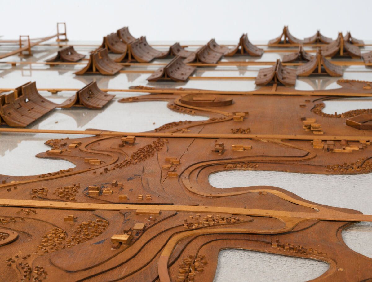
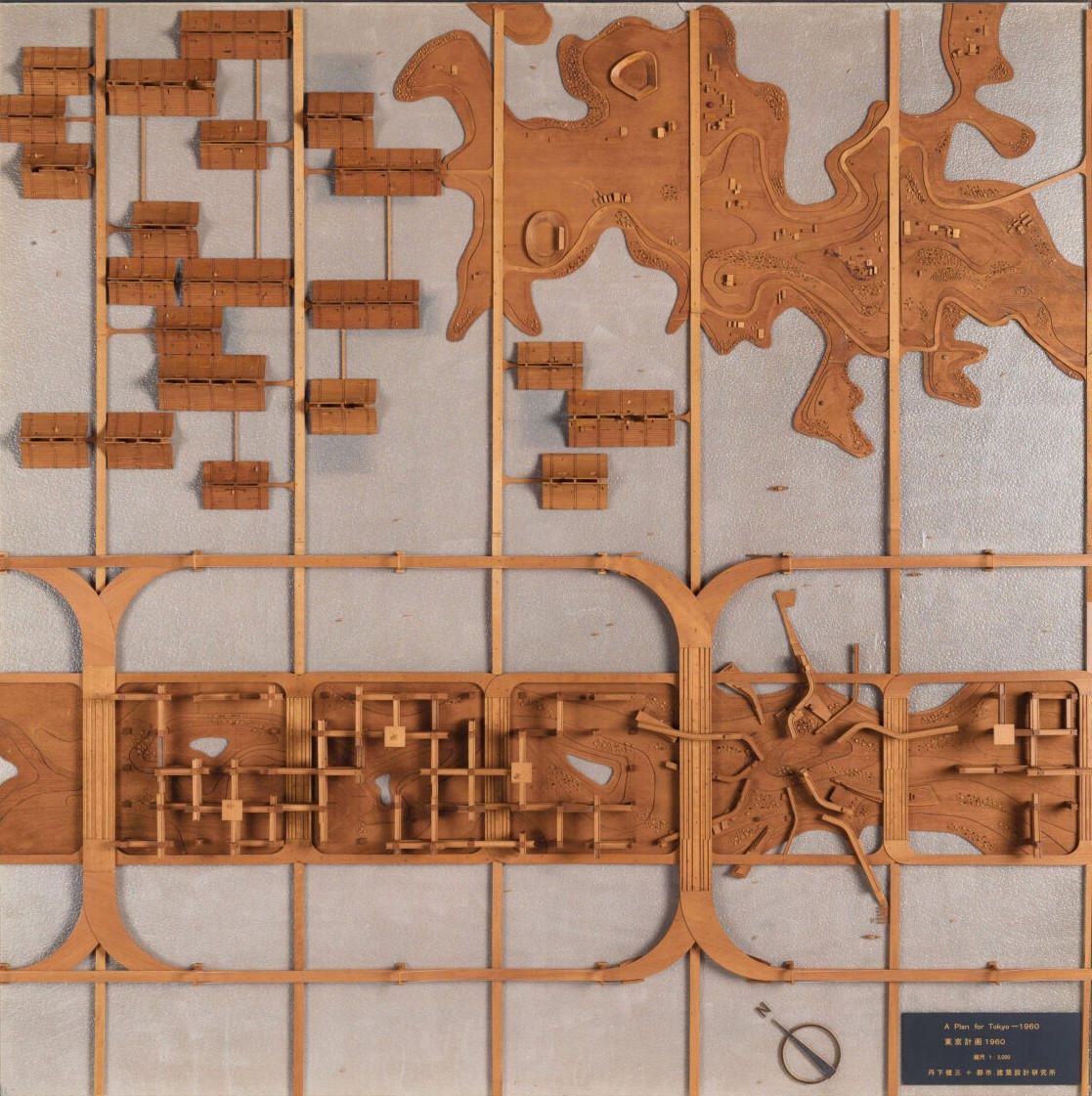
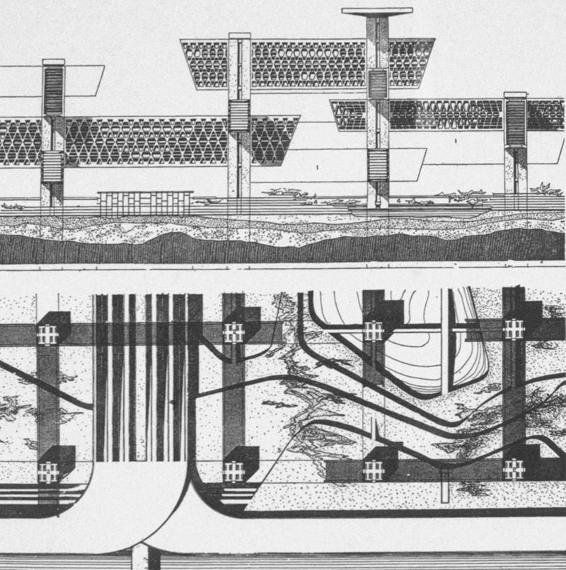
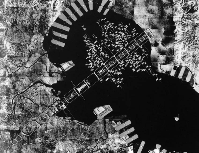
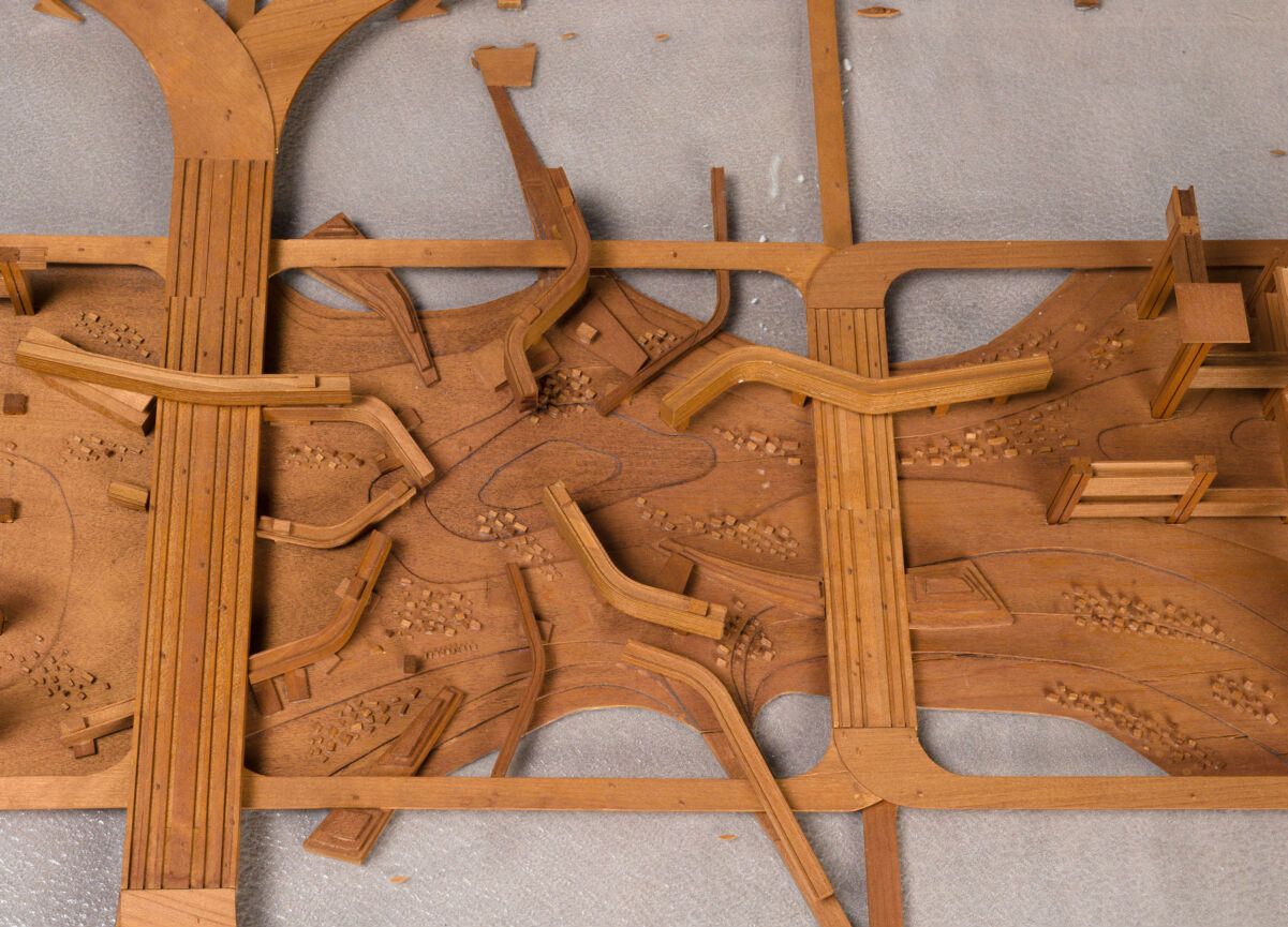
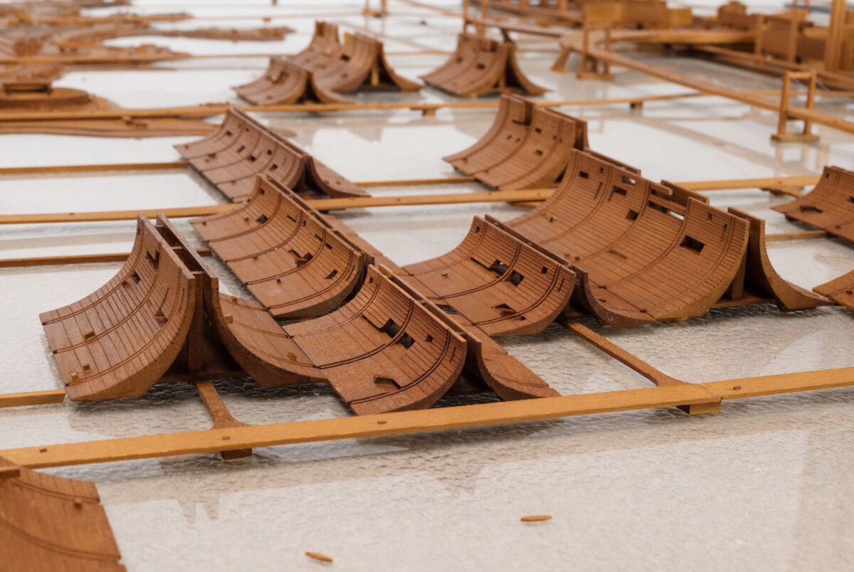
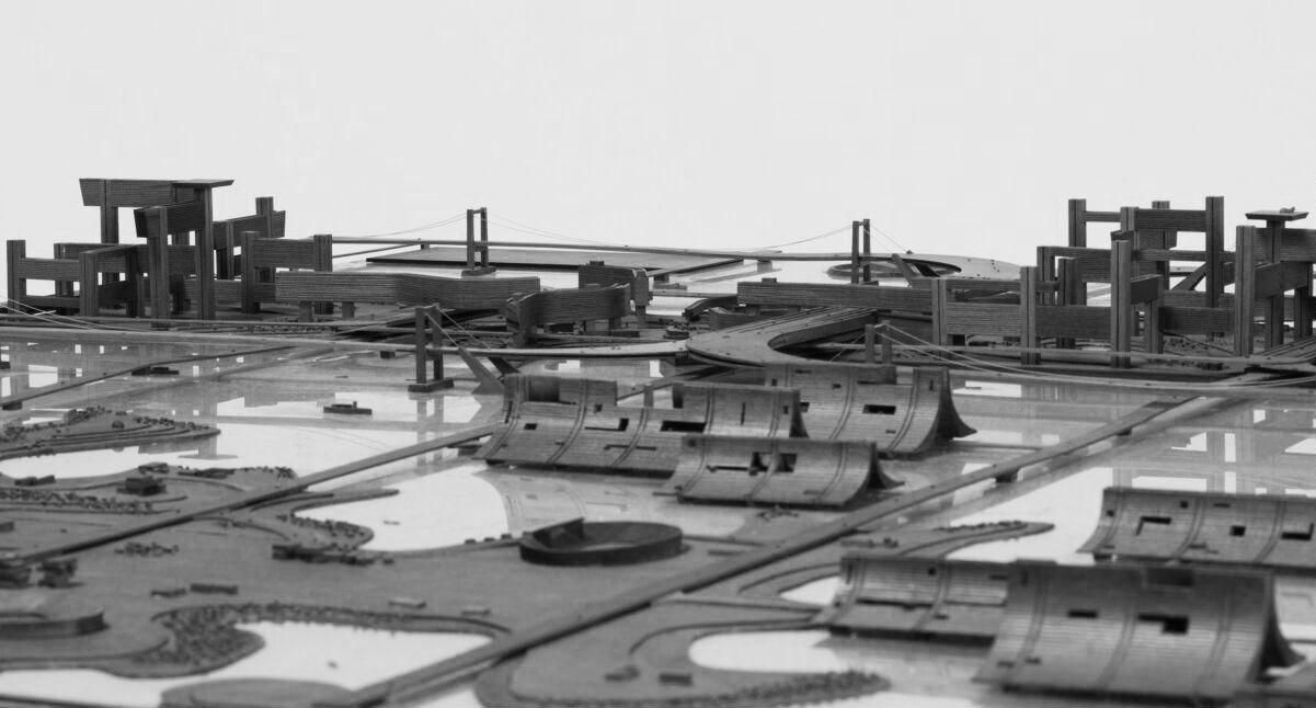
Kenzo Tange’s Plan for Tokyo 1960 was a visionary proposal aimed at addressing the unprecedented challenges facing Tokyo. By the late 1950s, Tokyo was experiencing rapid economic expansion and urbanization, driven by Japan’s post-war economic miracle. The metropolitan area faced issues of population growth, and the limitations of existing infrastructure. To address these issues, Tange proposed an ambitious 18-kilometer linear megastructure extending into Tokyo Bay, designed to accommodate 5 million additional residents and alleviate pressure on the city’s existing population of 10 million. Inspired by traditional Japanese urban design and modernist influences, Tange's Plan for Tokyo aimed to redefine urban development by shifting from a traditional radial system to a linear model that could accommodate future growth. With the principles of Metabolism—a movement that emphasized organic growth and modular expansion—Tange's plan sought to reconceptualize Tokyo as an expandable and adaptable urban system that could evolve over time to meet the needs of its residents and industries, such as the concept of “artificial land” along the bay which provides new spaces for development while alleviating pressure on the existing urban setting. By extending the city over water, the plan addressed Tokyo’s land shortage while introducing a clearly organized spatial structure that integrated architecture, infrastructure, and social vision. Although never realized, Tange’s proposal brings a new order and new meaning to the potential of large-scale, forward-thinking master planning.

Project Leads

  • Kenzo Tange

Organizations

  • URTEC (Urbanists and Architects Team)
  • Japanese Ministry of Construction

Stages

  • Schematic Design
  • Design Development
  • Planning
Intersection of civic & communal axis
Residential zones of Tokyo bay

Site

Plan of Residential areas
In his Plan for Tokyo Redevelopment, Kenzo Tange aimed to achieve three interrelated objectives. First, he proposed a shift from a traditional centripetal structure (everything converges toward a central core) to a linear urban development. Second, Tange sought to unite the city’s structure, transportation systems, and architecture into a cohesive framework. Finally, he established a new urban spatial order that would reflect the open organization and spontaneous mobility of contemporary society. The plan revolved around a linear megastructure featuring interlocking loops that formed a central spine extending approximately 18 kilometers into Tokyo Bay. This spine was envisioned as the primary infrastructure supporting the city's entire urban expansion. Mobility features included a multi-layered transportation system. A high-speed expressway served as the backbone of the city, complemented by secondary roads for efficient traffic management and an extensive subway network for mass transit. Elevated walkways separated pedestrians from vehicular traffic, ensuring safety and uninterrupted movement. The introduction of floating and elevated urban platforms is another distinctive feature of the plan, inspired by marine and industrial engineering. These platforms and artificial islands were designed to accommodate housing, commercial, and industrial zones, enabling Tokyo to expand over water and circumvent land shortages. Future urban expansion was envisioned through both vertical and horizontal growth, layering different urban functions within the megastructures. High-density residential zones coexisted with commercial and industrial areas in a meticulously planned spatial hierarchy. The design clearly defined functional zones—residential, commercial, industrial, and recreational—each intended to be self-sufficient while remaining interconnected via the central transportation spine.

Typology

Urban adaptation, infrastructure, transportation networks

Land use type

Mixed Use

Size

618,000 acres (Planned area)

Population/density

16.2 people per acre (In the late 1960s)

Community Infrastructure

  • public transportation
  • physical mobility

Timeline

1959-1970

People

Awards

Media

Filters:
No records.

Texts

Filters:
No records.

Bibliography

Sort